Region 2 West: The Kenai Peninsula
The Kenai Peninsula hosts some of the best road-accessible freshwater fishing in the state (the Kenai and Russian rivers, for example), and provides popular jump-off points for saltwater halibut, lingcod, rockfish and salmon fishing out of Valdez, Whittier, Seward, the Deep Creek / Ninilchik area, and Homer.
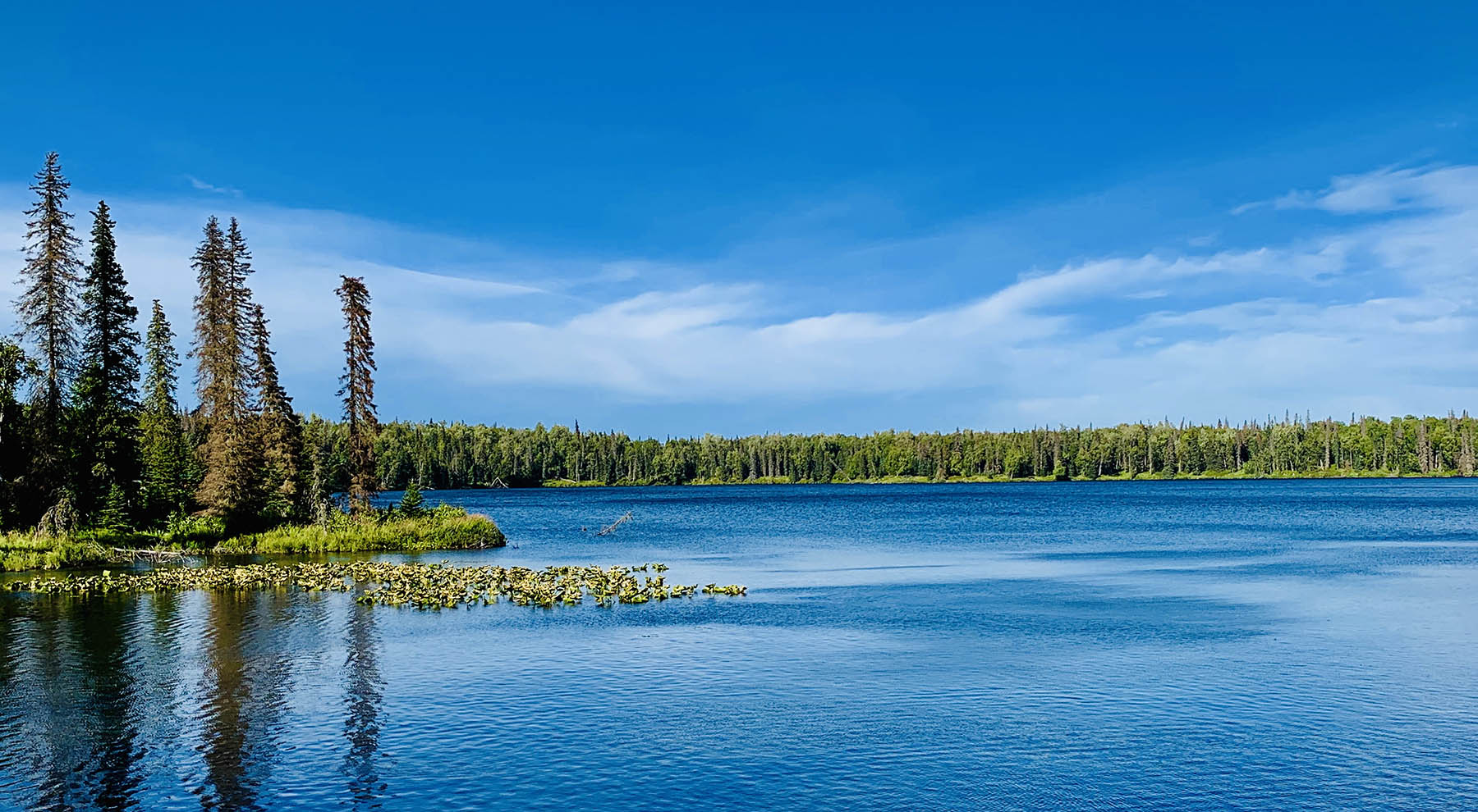

Located within a 40-minute drive from Anchorage, the Kenai Peninsula is a mecca for outdoors-oriented people from all over the world. It is the playground for local residents from all over the state, with a daily traffic flow south out of Anchorage along the Seward Highway, to various places of interest all over the Kenai Peninsula. It encompasses a wide variety of outdoor activities from fishing and hunting, to dipnetting, clamming, flight-seeing, river rafting, hiking, camping, ATV riding, horseback trail riding and saltwater boating and fishing.
The Road System
To get there, you drive south of Anchorage, to Whittier and on to the Kenai Peninsula. With the exception of Seldovia, a quaint little village on the edge of Kachemak Bay, all of the towns on the Kenai Peninsula are on the road system, so getting to Seward, Moose Pass, Cooper Landing, Sterling, Soldotna, Kenai, Ninilchik and Homer (where the road ends) is not a problem.
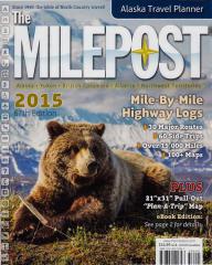 The best guidebook by far to the roads on the Kenai Peninsula is the Alaska Milepost, with detailed directions to any place you want to go, including camping areas, pullouts, fuel stops, and lots of good tips on avoiding trouble. The Milepost is a must-have for any extended road trips you take in Alaska. Pick up your copy HERE.
Essential Guidebooks and Maps
- Alaska Milepost
- Seward Highway Guide by Doug Lindstrand
- 50 Hikes in Alaska's Kenai Peninsula
- Kenai Trails by Alaska Geographic (map)
- Kenai National Wildlife Refuge (map)
- Kenai Lake and Vicinity (includes Russian River) map
- Kenai Peninsula; Northwestern Portion (map)
- Kenai River; Skilak Lake to Cook Inlet (map
- Kachemak Bay (includes Homer and Seldovia) map
- Homer Road Map
- Fishing Alaska's Kenai Peninsula by Dave Atcheson
- The Highway Angler by Gunnar Pedersen, Rene Limeres
- Bank Fishing for Steelhead and Salmon, by Scott Haugen
Lodging and Campgrounds
The Kenai Peninsula contains both public and private campgrounds, many of which require advance reservations. It can be difficult or impossible to find a vacant campsite during the summer here. Most campsites requiring reservations are booked early the previous winter, so get an early start if your plans include a stay in one of the campgrounds.
If camping is not your style, consider any of the many other options. Seward, Kenai, Soldotna and Homer provide many different types of lodging, including hotels, private cabins, and RV parking that may or may not include full hookups. Search our Directory for specific listings. Check the following links for specific listings on the Kenai Peninsula:
Kenai Peninsula Campgrounds (includes RV parks)
Kenai Peninsula Bed and Breakfast establishments
Cruising the Kenai Peninsula
Several cruise lines serve the Kenai Peninsula communities of Whittier and Seward, so if you are taking a cruise to Alaska, keep in mind that a popular itinerary takes you to one of these coastal communities. Some cruise lines will transport you from either town via bus or rail north to Anchorage and beyond. Many cruise packages are available; contact your cruise line for details and itineraries. Some cruise lines like to keep you in their ecosystem of commercial service providers and activities; this can be a great way to experience Alaska, however keep in mind that many commercial services exist outside this system. Do your research carefully or you could miss out on some of the best Alaska has to offer! An example of this is an itinerary that does not allow enough time in Whittier or Seward to take in a charter fishing trip (charter trips often leave in early morning and will spend eight or more hours on the water). How will you keep your catch aboard the boat? Not to worry! Many fishing charters will arrange to vacuum pack and freeze your fish, shipping it to you once you arrive at home. Alternatively you can haul it home, vac-packed and flash-frozen, on the airlines, if you are heading home right away. There are many ways to handle this.
Other activities may include whale-watching or wildlife cruises on saltwater, whitewater rafting on the Kenai River, flight-seeing, hiking, mountain biking or fishing any of the dozens of lakes and rivers on the Kenai Peninsula.
The Alaska Marine Highway System
The State of Alaska's ferry system serves Whittier, Chenega Bay, Seldovia, Homer, Kodiak and Port Lions, before continuing on to the Alaska Peninsula. Vehicles are allowed on the ferry. Amenities include staterooms (must be reserved well in advance), bathrooms with showers, hot and cold meals and drinks for purchase, alcoholic beverages and much more. For travelers on a budget, sleeper recliners are available, tents can be set up in certain areas aboard ship, or you can simply roll out your sleeping bag for a night under the stars. You can even bring a cooler along with your own food if you prefer. The schedule varies from winter (October through April) to summer (May through September). Visit the Alaska Marine Highway website for schedule and pricing information. Or visit their YouTube site for video snapshots of the ships, the amenities, and to discover this unique transportation system for yourself.
| Route Segment | Running Time | Naut. Miles | Stat. Miles |  |
|
| Valdez-Cordova | 5.5 hours | 74 | 84 | ||
| Cordova-Whittier | 6.25 hours | 97 | 110 | ||
| Whittier-Valdez | 6.75 hours | 78 | 89 | ||
| Kodiak-Port Lions | 2.5 hours | 48 | 55 | ||
| Port Lions-Homer | 10 hours | 134 | 152 | ||
| Homer-Seldovia | 1.5 hours | 17 | 19 | ||
| Homer-Kodiak | 9.5 hours | 136 | 155 | ||
Hiking the Kenai Peninsula
The Kenai Peninsula is a hiker's paradise, with many miles of trails that can be an end in themselves, or used as a way to access some of the area's prime fishing and hunting opportunities. Here is a list of some of the more popular trails available.
Caine's Head Trail
This trail takes hikers from Lowell Point, near Seward, through tidelands 4.5 miles to the Caine's Head State Recreation Area. A section of this trail can be accessed only at low tide, so bring your tide tables! Tides must be +3' or lower to access this area. The trail takes you to North Beach, the site of an old Army dock that was damaged by the Good Friday earthquake in 1964. The land sunk four feet in this area, and the decking on the Army dock was mostly destroyed by waves in subsequent years. The structure is considered unsafe; if you access this area by boat, do not tie off on the pier; instead, beach your boat. The North Beach area contains picnic sites, camp sites, and latrines. From trail splits in the Derby Cove area, with the inland fork taking hikers up to a scenic vantage point on a headland overlooking Resurrection Bay. The trail descends to the bay to the South Beach, which also contains campsites. Take the coastal trail north to the North Beach area. Along the way you will see numerous points of interest, including Fort McGilvray, an army installation that was abandoned after World War 2. It once housed 500 troops, who manned a gun emplacement that was positioned there to protect Seward from enemy attack by sea. Other buildings in the area supported the Fort. The buildings are not maintained, and many of them are not safe to enter. Proceed with caution!
The Derby Cove Public Use Cabin is located at Derby Cove The Callisto Canyon Cabin is located four hiking miles from Lowell Point, at the south end of the beach between Lowell Point and Derby Cove, against the mountains. Both cabins have two sets of full-sized bunk beds (no bedding), countertops, a table, benches, a wood stove and a latrine. Bring your own bedding, toilet paper and supplies, and tools for cutting and splitting your own wood. Each cabin has nearby freshwater streams, but it is recommended that all water should be filtered, boiled or treated (see our article, "Don't Drink the Water!", by Michael Strahan, for more information on water treatment options in Alaska. Cabin reservations can be made online AT THIS LINK. Alaska residents can reserve a cabin no earlier than seven months to the day from the intended date of occupancy, and nonresidents can reserve a cabin no earlier than six months to the day from the first date of intended occupancy. Reservations can be made online or in person at the nearest Alaska State Park office. More details and additional information can be found AT THIS LINK.
Learn more about the Caine's Head Trail system and the Caine's Head State Recreation area on the DNR site AT THIS LINK.
Crescent Lake Trail
Devil's Pass Trail
Emerald Lake Trail
The Emerald Lake Trail is accessed via water taxi from Homer, landing at either the Humpy Creek trailhead or the Glacier Spit trailhead. The trail consists of a 13.2 mile loop, and has hikers crossing a swift river via hand-operated tram, a bridge crossing, and views of Emerald Lake. Humpy Creek contains a healthy run of pink ("humpy") salmon, and the area is well-traveled by black bears during the summer months. Expect to see goats on the mountains above the area. Black bears can be found in the fall months by hiking above treeline, where the bears are feeding on blueberries.
There are no campgrounds or other public facilities in this area.
Read the Guide to Emerald Bay Loop and Mallard Bay Scenic Trails guide AT THIS LINK for more information.
Fuller Lakes Trail
The Fuller Lakes Trail begins at a trailhead at MP 57, on the north side of the Sterling Highway, not far from Cooper Landing. It's a relatively steep three-mile hike from the trailhead to Lower Fuller Lake. The outlet of the lake is marked by a beaver dam. The lake offers good fishing for grayling. The trail continues around the right-hand side of Lower Fuller Lake, to Upper Fuller Lake. According to the Alaska Department of Fish and Game, some trees in the area have been sampled by federal biologists and found to be over 500 years old. Dall sheep are found on the slopes above, along with black bear.
Johnson Pass Trail
The Johnson Pass Trail extends 23 miles from the north trailhead, through the Kenai Mountains to Trail River. It is part of the original Iditarod Historic Trail, and was built in the early 1900's as a route for dog teams and horses to get from the port at Seward to gold fields near Iditarod.
Lost Lake / Primrose Trail
This popular trail extends 15 miles from a gravel road at Mile 5 of the Seward Highway, past Lost Lake and north to the trailhead at Primrose Campground at the southern tip of Kenai Lake. Most hikers that tackle this trail do so from the Primrose side, and only hike the 7.3 miles to Lost Lake, overnight there, and hike back to Primrose. Lost Lake offers excellent fishing for rainbow trout. Because this is a popular hiking trail, Leave No Trace principles should be vigorously followed. Campfires are not recommended, as the substrate is vegetative and can catch fire easily. Camping on Lost Lake peninsulas is not recommended, as the tundra has been damaged over the years by campers. Choose sites that allow minimal impact.
A primitive (non-enclosed) latrine can be found at Lost Lake, along with a bear-proof food storage box, but no other amenities exist along the trail. The Primrose Campground includes many amenities, including campsites, latrines, tables, fire pits (bring your own wood), garbage dumpsters, and a boat ramp on Kenai Lake.
More information on the Lost Lake / Primrose Trail can be found AT THIS LINK.
Resurrection Pass Trail
The Resurrection Pass Trail, one of Alaska's most popular trails, extends 38 miles from Hope to Cooper Landing. The trail is a popular access corridor for summer hikers, horseback hunting trips, hike-in hunting and fishing, mountain biking and cross-country skiing. Some lakes along the way allow for floatplane access. Most hikers camp along the trail, however a number of cabins are available and are scattered all along the trail, making it possible to stay in a cabin every night, if you prefer. There are seven cabins on the trail, and one remote cabin at Swan Lake, that can be accessed only via floatplane. Here is an overview of the cabins, starting at the Hope end of the trail:
- Caribou Creek Cabin: 12x14' cabin, bunks can sleep four, with room for four more people sleeping on the floor (bring your own bedding), table, benches, wood stove (bring your own wood, as surrounding wood supply will be depleted by other campers), an outhouse, and a porch area with benches for sitting and swatting mosquitos. Fresh water available in nearby creek, but it must be filtered, boiled or treated. Most campers bring a backpack stove for preparing food. Fishing opportunities are poor.
- Fox Creek Cabin: 14'x17' cabin with amenities identical to those at the Caribou Creek Cabin. Fishing opportunities are poor.
- East Creek Cabin: 12'x14' cabin with amenities identical to those at the Caribou Creek Cabin. Fishing opportunities are poor.
- Swan Lake Cabin: 12'x14' cabin with amenities identical to those at the Caribou Creek Cabin. Water is available from Swan Lake, but it must be filtered, boiled or treated before drinking. Access is via Resurrection Pass Trail or floatplane on Swan Lake. Fishing for rainbow trout, Dolly Varden and lake trout in Swan Lake. A rowboat and oars is provided at the cabin.
- West Swan Lake Cabin: 12'x14' cabin with amenities identical to those at the Caribou Creek Cabin. Water is available from Swan Lake, but it must be filtered, boiled or treated before drinking. Access is via floatplane on Swan Lake (there is no trail linking this cabin to the Resurrection Pass Trail. The lake is situated in a steep-walled canyon, making overland travel from the trail system all but impossible for most hikers. Fishing for rainbow trout, Dolly Varden and lake trout in Swan Lake. A rowboat and oars is provided at the cabin.
- Juneau Lake Cabin: 14'x17' cabin with amenities identical to those at the Caribou Creek Cabin. Access is via the Resurrection Pass Trail or by floatplane to Juneau Lake. Fishing for rainbow trout, lake trout, grayling, whitefish and burbot. This is a popular cabin, so reserve it early. Tales are told of campers who had to move out because they thought it would not be reserved.
- Romig Cabin: 14'x17' cabin with amenities identical to those at the Caribou Creek Cabin. Access is via the Resurrection Pass Trail or by floatplane to Juneau Lake. Fishing in nearby Juneau Lake for rainbow trout, lake trout, grayling, whitefish and burbot. This is a popular cabin, so reserve it early.
- Trout Lake Cabin: 14'x17' cabin with amenities identical to those at the Caribou Creek Cabin. Access is via the Resurrection Pass Trail or by floatplane to Trout Lake. Fishing in nearby Juneau Creek for rainbow trout, Dolly Varden, and grayling. Trout Lake itself offers good fishing for rainbow trout and lake trout. A rowboat and oars are provided.
NOTE: these cabins are available by reservation AT THIS LINK. Don't end up out in the cold! Reserve the cabin in advance, or you could be kicked out by the group that reserved it!
Russian River Trail System
The Russian River is one of the most popular sockeye fisheries in the state of Alaska. The Russian Lakes trail system takes hikers and mountain bikers to the headwaters of the Russian River, upper and lower Russian Lakes. The trail extends 21 miles from a trailhead just off the Russian River access road, across relatively flat ground to Lower Russian Lake. When you get to the lake, take a right turn to go to Russian River Falls, where you can see thousands of red (sockeye) salmon gathered on their push during the summer run. There are two sockeye runs on the Russian, along with a late run of silver (coho) salmon, so you have ample opportunity to see salmon in the river. Be aware that black bears and brown bears use the river heavily during the summer; bring bear protection! There is a fish weir at the outlet of the lake, operated by the Alaska Department of Fish and Game. Stop at the weir for some great photos of migrating salmon, but do not disturb the weir, and be advised to avoid this area in the early morning and late evening hours, because these are prime periods of activity for the area's bears.
After viewing the falls, head back east on the trail to follow the shores of Lower Russian Lake. The trail takes you past the Barber Cabin, one of two public use cabins in the area. The cabin is 16'x20', with bunks that can sleep four comfortably. There's room for four more people sleeping on the floor (bring your own bedding). A table, benches, a wood stove, and an outhouse are provided. Bring your own wood, as nearby dead wood will have been burned by other campers using the cabin. Fresh water available in nearby Lower Russian Lake, but it must be filtered, boiled or treated. Fishing is available for rainbow trout, Dolly Varden and grayling. The area is closed to salmon fishing. A rowboat and oars are provided. Access to the cabin is via the Russian River Trail or by floatplane.
Continue past the Barber Cabin to Upper Russian Lake, where you'll find the Upper Russian Lake Cabin, a 12'x14' log structure that will house four people in bunks (bring your own bedding, and another four on the floor if you like. The cabin includes a table and benches, an outdoor toilet, and a rowboat with oars, so you can enjoy fishing for rainbow trout, Dolly Varden, and grayling in Upper Russian Lake.
The Russian River Trail is well-maintained and accessible by hiking and mountain biking, as well as horseback.
NOTE: these cabins are available by reservation AT THIS LINK.
Summit Pass Trail
Swan Lakes / Swanson River Canoe Trail system
The Swan Lakes / Swanson River Canoe Trail system is not a hiking trail per se, it's a canoe portage route taking you through a chain of lakes and portage trails. The Swanson River system provides many options, from day trips, to weekend adventures that loop you back out to the road, to an expedition which eventually puts you in the Swanson River, from which you can navigate out to the road system. The trail system offers a number of options, including shorter trips or long trips of a week or more, depending on which lakes you opt to visit. Note that several lakes of interest are found off the trail system, and are therefore rarely visited. Many of these lakes present ideal fishing opportunities for rainbow trout, lake trout, grayling, and Dolly Varden. Big-game hunters can find opportunities for moose hunting in the area, as well as chances at small game such as snowshoe hare and grouse. The area is heavily wooded, with forests of birch, spruce, and cottonwood, with an understory of willow and alder.
An excellent resource on this area is Daniel L. Quick's great book, "Kenai Canoe Trails", a full-color guidebook to the canoe trail system. This book is currently out of print, however it can be found on the used market, and is a must-have for anyone accessing the canoe trail system.
Flying the Kenai Peninsula
The Kenai Peninsula has several year-round airports to choose from, including three that offer daily commuter service from Anchorage to Seward, Kenai, and Homer. All three towns offer charter Bush flights to remote locations on the Kenai Peninsula, or the Alaska Peninsula, which is located to the north, across Cook Inlet. Other airports / airparks are located in Hope, Moose Pass, Nanwalek (formerly English Bay), Port Graham, Quartz Creek, Seldovia, Soldotna, and Sterling.
Kenai Peninsula Boating Opportunities
The Kenai Peninsula offers excellent opportunities for both freshwater and saltwater boaters. The port towns of Whittier, Seward, and Homer all offer launch facilities, fuel, shore-based lodging, dry boat storage, permanent or transient berths, fish cleaning stations and many other amenities of interest to power boaters or sailors. All of these locations are within striking distance of outstanding fishing for salmon, halibut, rockfish and ling cod, and all of them provide excellent access to prime public hunting areas.
Kenai Peninsula Boat Launch Facilities
Whether you're looking at freshwater or saltwater, you need to know where the launch ramps are. Check out our Region 2 Boat Launches page for locations and instructions.
Saltwater Boating on the Kenai Peninsula
The Kenai Peninsula offers excellent saltwater fishing opportunities, including sailing, powerboating (by far the most popular) and even sea kayaking. Ocean kayaking is very popular in the Seward area, and also out of Whittier. It is growing in popularity in Kachemak Bay (near Homer), with paddlers crossing the bay on a calm day to visit Halibut Cove, Yukon Island, or the quaint little seaport of Seldovia. Some kayakers can be seen on occasion trolling for king salmon along the Homer Spit, or along the coast past Anchor Point, off the beaches of Ninilchik or in the Deep Creek area. Some charterboat operators offer kayak drop-offs and pick-ups by prior arrangements, which give sea kayakers the chance to experience remote areas without having to go to the extra work of paddling all the way. A water taxi service offers day-trippers a departure from Homer to Seldovia, where you can wander the streets, have some lunch or do a little shopping before catching a ride back to Homer and the road system. Although the southern side of the Kenai Peninsula offers rugged, rocky coves and relatively deep water, the north side is a sharp contrast, with shallow, sloping beaches and exposed coastlines for the entire distance. Several locations on the north side of the Kenai Peninsula offer boat launch facilities. There are two ways to launch a boat at the Deep Creek State Recreation Area. You can launch the boat yourself from the beach, but you must have some experience with this before attempting it. Launching must be timed with the tides, with special attention paid to the weather and wind-driven waves. There's a tractor service that can launch your boat off the beach, regardless of the tide. It's expensive, but most boaters believe it's worth it, considering the risk of losing a mired vehicle to a rising tide. Check the following pages for additional details on saltwater boating on the Kenai Peninsula.
Deep Creek | Homer | Kenai | Seward | Whittier
Freshwater Boating on the Kenai Peninsula
Powerboating is limited to a number of lakes on the Kenai Peninsula, and the Kenai River itself, from the mouth upstream through Skilak Lake (power boating upstream of the Kenai's inlet to Skilak Lake is prohibited. On any body of water that drains into the Kenai River, including lakes in the Kenai watershed, outboard motors are limited to four-stroke or motors that use fuel injection. Contact Alaska's Department of Natural Resources for more current information and details concerning these regulations. The intent of these restrictions is to keep the waters of the Kenai clean and healthy for the numerous species of anadromous and resident fish healthy. Since the implementation of these restrictions on the Kenai Watershed, the waters of the Kenai have become noticeably cleaner. Do your part!
The Kenai Peninsula contains many road-accessible and remote lakes. Here are some of the most popular ones; simply click the name to learn more about them.
Crescent Lake | Fuller Lakes | Hidden Lake | Kenai Lake | Swanson Lakes | Tustemena Lake
The Kenai Peninsula contains several river systems of interest to recreational floaters, including hunters and fishermen. Floaters who are limited to the road system are in an ideal situation because some of the state's best rivers are simply a short drive away. On the other side of the coin, ease of access also can mean that these areas are often crowded, particularly on holiday weekends. Floaters looking for an isolated experience can find it on the Kenai Peninsula, but it requires more work than it does in other regions that are mostly or exclusively roadless. Click the river title to read more.
CAUTION: Before embarking on a river trip anywhere in Alaska, do your homework! Double-check your information against details from your air charter, get flow information from the Alaska-Pacific River Forecast Center (APRFC), and other floaters. Check our Boating Forums for discussions with people who have been there. If you are not familiar with the characteristics of Alaska's rivers, read our River Information page for a general orientation, and a list of resources to get you started on the learning process.
Anchor River | Granite Creek | Kasilof River | Kenai River, lower | Kenai River, upper | Moose River | Northern Cook Inlet | Ptarmigan Creek | Quartz Creek | Resurrection Creek | Russian River | Sixmile Creek | Swanson Lake Canoe Trails | Trail River
Kenai Peninsula Fishing
The Kenai Peninsula is the ultimate destination of many resident and nonresident anglers, with people coming to Alaska from all over the globe to sample the varied angling opportunities available. Because the area is so popular, numerous measures have been undertaken to reduce signs of human impact and improve conditions for fish in the Kenai Peninsula's lakes, rivers, and marine environments.
Species
Check out these species pages for the types of fish you may encounter on the Kenai Peninsula:
King Salmon | Pink Salmon | Red Salmon | Silver Salmon | Chum Salmon | Halibut | Hooligan | Lingcod | Pacific Cod | Rockfish | Salmon Shark | Grayling | Lake Trout | Pike | Rainbow Trout | Dolly Varden
Regional Details
For details on specific fishing areas on the Kenai Peninsula, including amenities and equipment / service providers in these locations, please visit our pages on the following areas:
Kenai Peninsula Fishing Intro | Upper Kenai Peninsula Fishing | Central Kenai Peninsula Fishing | Lower Kenai Peninsula Fishing | Kenai Peninsula Marine Fishery | Kenai Peninsula Clamming | Seward Saltwater Fishing
Kasilof River Dipnetting | Kenai River Dipnetting
Anchorage | Homer | Kenai / Soldotna | Northern Cook Inlet | Seward | Whittier
Resources
If you plan to fish anywhere on the Kenai Peninsula, you need a copy of Dave Atcheson's "Fishing the Kenai Peninsula" in your rig. If you're new to the area, a copy of The Milepost will help you plan your trip, providing maps and detailed information on the locations of campgrounds, cabins, places to eat, fuel stops and much more. While you're in the bookstore, you might also check out our maps of Kachemak Bay State Park, Kenai River (includes only the middle and lower sections of the river, from Skilak Lake to the mouth), and the Northwestern Kenai Peninsula map, which includes only the areas around Kenai, Soldotna, Sterling, Kasilof, and Nikiski. These are road maps, but they also show campgrounds, fishing areas and available species. Finally, check out Scott Haugen's excellent book, "Bank Fishing for Steelhead and Salmon" for excellent tips that will work on the Kenai River, Deep Creek and other places on the Kenai Peninsula.
Check our special species pages for the following fish species you may encounter on the Kenai Peninsula:
King Salmon | Pink Salmon | Red Salmon | Silver Salmon | Chum Salmon | Halibut | Hooligan | Lingcod | Pacific Cod | Rockfish | Salmon Shark | Grayling | Lake Trout | Pike | Rainbow Trout | Dolly Varden
Check the ADF&G website for details on the following available saltwater species.
Atka Mackerel | Black Cod | Chum Salmon | Cutthroat Trout | Dolly Varden | Halibut | King Salmon | Lingcod | Pink Salmon | Pollock | Red Salmon | Salmon Shark | Silver Salmon | Steelhead | Yelloweye Rockfish
Kenai Peninsula Hunting Opportunities
The state of Alaska is divided into 26 Game Management Units (GMU), some of which are divided further into sub-units. Each of these units or sub-units may contain different species, different seasons, and different legal requirements for hunting. GMUs are aggregated into regional groupings, and each of these regions operate under the oversight of a team of ADFG employees, including area biologists who are responsible for game management in their assigned portions of the region. There are five regions in the state of Alaska. Outdoors Directory uses these regions to divide the state into smaller pieces, for the sake of organization. When you plan your Alaska hunt, you need to know both the GMU in which you will be hunting, and the region. In this way you can ensure you are following the correct regulations for the area, and you know which regional biologist to contact for details about that area.
Region 2 contains GMUs 6, 7, 8, 14(C) and 15, and covers 25,645 square miles (an area slightly larger than the state of West Virginia). The ADF&G Region 2 office is located in Anchorage.
The Kenai Peninsula itself is comprised of only two Game Management Units; GMU 7 consists of the eastern portion of the Kenai Peninsula from the Hope area to Portage, and south to Cape Fairfield west to Gore Point. It includes Kenai Fjords National Park, where hunting is prohibited, and portions of the Chugach National Forest. GMU 15 includes the balance of the Kenai Peninsula west of the GMU 7 boundary, and also includes nearshore islands in Kachemak Bay as well as the Chugach Islands south of the Kenai Peninsula.
Check out the following pages for more details on hunting this area.
Kenai Peninsula | Hunting Southcentral Alaska
The Kenai Peninsula was legendary for its moose population around the turn of the century, however the habitat has mostly recovered from the old burns that were there years ago and the habitat has gotten less favorable for moose. Even so, the Tustemena Lake area (draw hunt) is known to produce some large bulls, and other areas on the Kenai are good for moose hunting. The Kenai Peninsula also offers good hunting for goat, Dall sheep, brown / grizzly bear and even caribou. As is true anywhere else in Alaska, good research will help you choose a productive location.
Species Information
Want to learn more about the critters that inhabit the Kenai Peninsula? Visit our species pages, where you'll find detailed instructions on the biology, distribution and how to hunt the big-game species that inhabit this area. Here are direct links to our pages on the species found in this region; note that we are including Sitka black-tailed deer, although they are not common in this area. Sightings have been reported in the Whittier area, and they are common on islands in Prince William Sound:
Black Bear | Brown Bear | Caribou | Dall Sheep | Goat | Moose | Sitka black-tailed deer | Wolf
ADF&G Region 2 Information
ADF&G Management and Harvest Reports, a vital hunt-planning tool, can be found AT THIS LINK. Reports are listed in sequential order by species. For detailed research into population trends, review several reports. For more recent data contact the area biologist. The Region 2 biologists are located in Anchorage. The phone number there is 1 (907) 267-2257.