State GMU Map
The state of Alaska is divided into 26 Game Management Units (GMU), some of which are broken into smaller subunits. This map shows each unit and subunit, and the green lines show the borders of each of the five regions in the state. A region includes all or part of certain GMUs and subunits. This site uses these regions to organize our location-specific information; refer to our Regions pages for descriptions of each. Each GMU contains species that may be unique to that area, together with different hunting seasons and different regulations from other regions. Pay close attention to the Alaska Hunting Regulations for unit-by-unit requirements and restrictions.
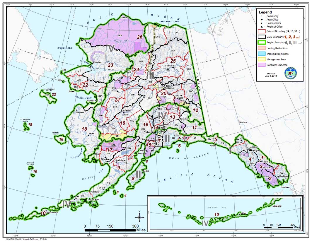
(map courtesy of ADF&G)
Notes on the GMU Map
REGION 1: Southeast Alaska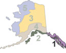
Commonly referred to as the "Panhandle", Southeast Alaska is composed of a number of large islands and a strip of coastline that borders British Columbia to the east. The area is roughly 480 miles long and 100 miles wide in places, and is the coastal rainforest of Alaska. Ketchikan is typical of the area, receiving an average of over thirteen feet of rain per year.
Because this area is large and encompasses some areas that are not easily accessed, this site separates Region 1 into "north" and "south" sub-regions.
Region 1 South: Southeast Panhandle | Region 1 North: Yakutat / Cordova Area
REGION 2: North Gulf Coast, Kenai Peninsula, and the Kodiak / Afognak Archipelago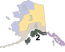
Region 2 includes the coastal waters associated with Prince William Sound from the Cordova area north and west. It includes the entire Kenai Peninsula, which hosts hunting opportunities for moose, brown bear, black bear, caribou, goat and Dall sheep. It also includes the storied Kodiak and Afognak islands, famous for brown bears, Sitka blacktailed deer, elk, and some of the best saltwater fishing in the state. This site divides Region 2 into "east" and "west" subregions. The eastern section includes the North Gulf Coast area and the Kenai Peninsula, while the western section includes the Kodiak / Afognak Islands area.
Region 2 East: North Gulf Coast / Kenai Peninsula | Region 2 West: Kodiak / Afognak Archipelago
REGION 3: Interior and Eastern Arctic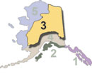
Alaska's Interior covers a huge land mass ranging from the Canadian border almost to Western Alaska, and encompasses the eastern third of the Brooks Range. It's an incredibly diverse area, with numerous lakes, rivers, mountains, and forests popular with fishermen, hunters, and other outdoor enthusiasts. The area gets quite warm in the summer, with temperatures ranging all the way up over 100º F. In the winter, this is typically the cold spot, with temps dropping to -65º F and even colder, for days on end. That's cold enough to shatter a plastic trash bag if you shake it outside, or turn a cup of hot water into steam before it hits the ground. This is one of the best places to see the Northern Lights in the winter, with Circle Hot Springs a premium destination.
This site divides Region 3 into eastern and western sub-regions, which are separated by the Parks Highway and the Dalton Highway (the "Haul Road").
Region 3 East: Eastern Arctic / Eastern Interior | Region 3 West: Central Interior
REGION 4: SouthCentral through the Alaska Peninsula and the Aleutians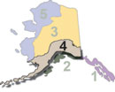
Southcentral Alaska contains the population center of the whole state, with the communities of Anchorage, Palmer, Wasilla, King Salmon, Dillingham, and many others out along the Alaska Peninsula and into the Aleutian Islands to and past the tiny community of Adak. Waterfowl hunting is good, as is big-game hunting for moose, caribou, black bear, brown / grizzly bear, and Dall sheep. There are many affordable opportunities for flight-seeing, and great opportunities for snowmachining the back-country in the winter months.
This site divides Region 4 into two sub-regions: Region 4 (east) extends from the Canadian border to the summit ridge of the Western Alaska range. Region 4 (west) runs from the Alaska Range, through the Lake Iliamna region and Bristol Bay out through the Aleutian Islands.
Region 4 East: Southern Interior, Anchorage, Susitna Valley | Region 4 West: Bristol Bay and the Alaska Peninsula
REGION 5: Arctic and Western Alaska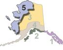
The Arctic is truly "the land of the midnight sun", with days growing noticeably longer during the spring bear season and though the daylight is waning in the fall months, you can expect long morning and evenings; prime times for hunting. This region is mostly inaccessible by road, however several airlines serve the villages scattered throughout the area, so access is good. Once you arrive in a village, any of a number of commercial air charter services offer wheel, float plane, or ski plane access to remote locations. Hunting opportunities include caribou, moose, black bear, brown / grizzly bear, Dall sheep, wolf and muskox.
This site divides Region 5 into "north" and "south" sub-regions. Region 5 (north) encompasses the western Arctic, south through the Seward Peninsula and ending south of Unalakleet at the border of GMU 18. Region 5 (south) includes the entirety of GMU 18, which includes the entire Yukon-Kuskokwim Delta region.
Region 5 North: Western Arctic | Region 5 South: Yukon / Kuskokwim Delta
